According to meteorologist Luca Mathias, the dust is being transported north due to a low-pressure system near the Iberian Peninsula. On the eastern side of this system, a strong southerly airflow is lifting sand from the Sahara into the upper atmosphere and carrying it towards Europe, he explained.
Weather models suggest that the highest dust concentrations will be over France on Friday, particularly at ground level. Luxembourg and parts of the UK are expected to be only lightly affected.
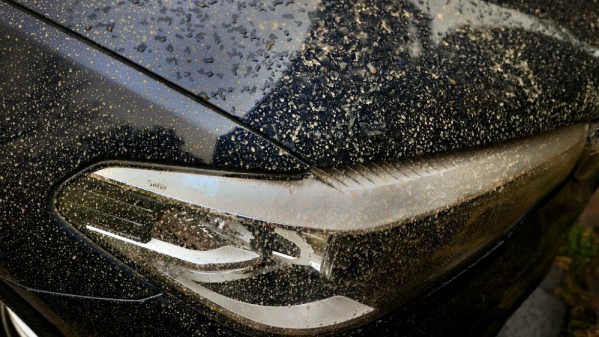
Although not a major event, residents may notice a fine layer of dust settling on cars and outdoor surfaces. So if you spot a thin film of reddish dust in the coming days, now you know where it came from.
Sahara sand fallout: Important tips for safely washing your car