These images may produce unpleasant memories for some in Luxembourg, but, fortunately, today's 'twister' was relatively harmless. In videos sent to editorial staff, a whirlwind flying over the city is visible before dissipating completely. However, the images do not make it possible to determine precisely whether the funnel cloud made contact with the ground or not.
According to the Kachelmann weather site, and the Boulaide Weather page, these wispy clouds could be described as 'scud' clouds, which eventually condense to create 'wall clouds' that are the beginning of a tornado's formation. When a hook protrudes from the cloud in a funnel-like formation (also called a 'funnel cloud') and then makes contact with the ground, a tornado is born.
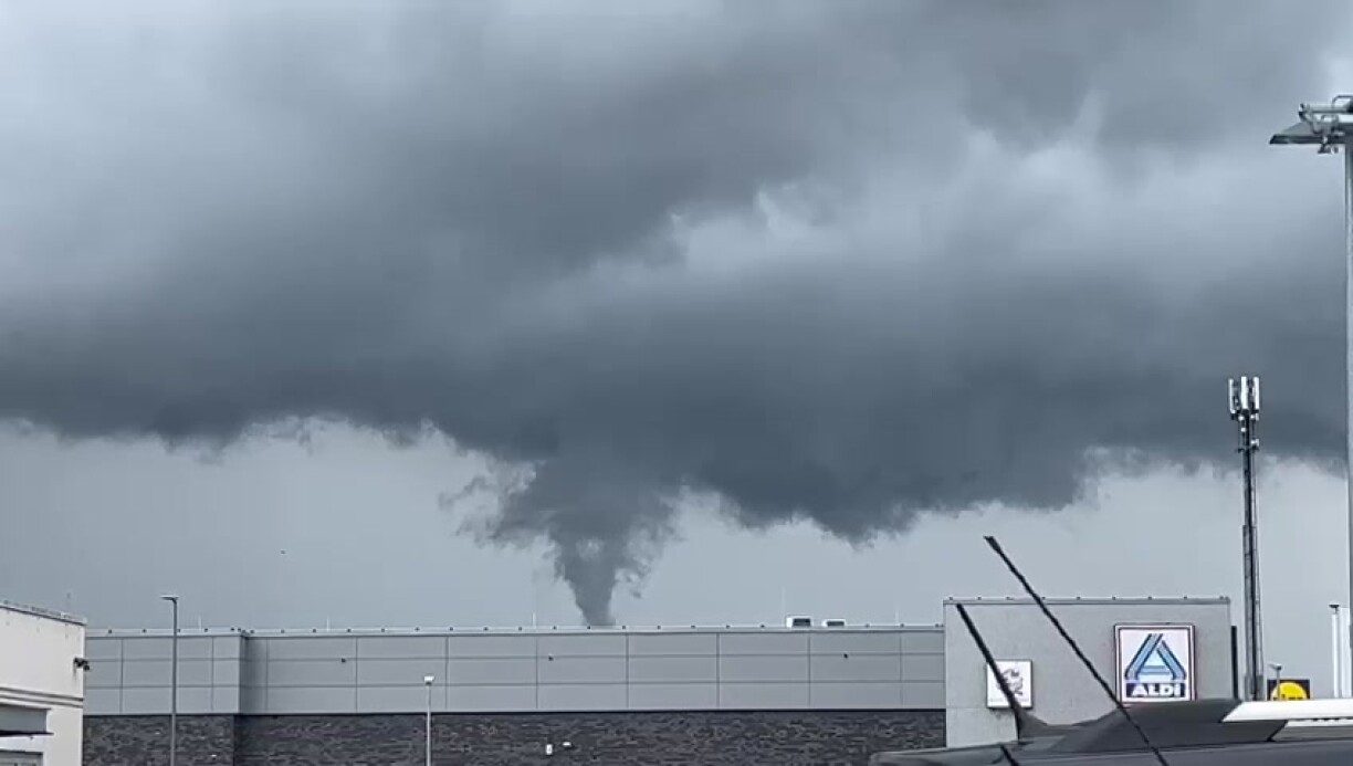
These phenomena generally form under very specific and particular weather conditions, alongside thunderstorms. A thunderstorm cell was reported in the area at the same time. Unlike a tornado, the funnel can extend to a certain height forming a whirlwind without reaching the ground.
Fortunately, the severity of today's event was nowhere near the category F2 tornado which devastated Pétange and Bascharage in August 2019.


