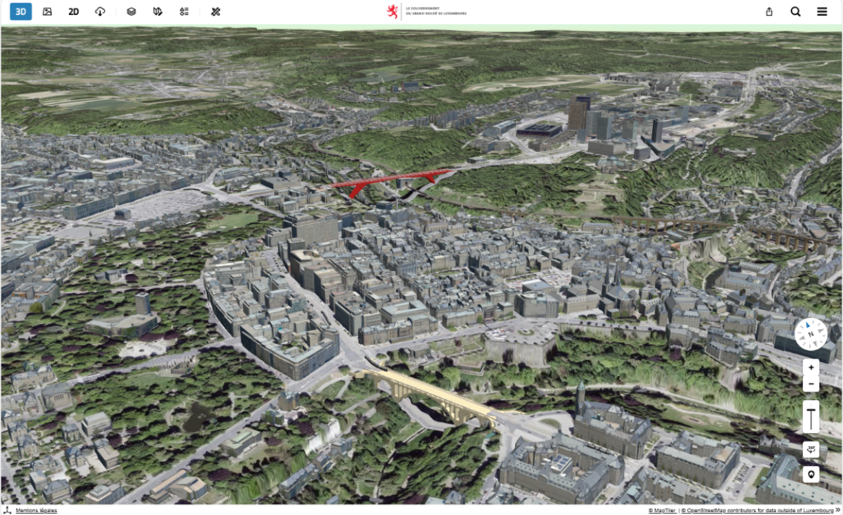
The National Geoportal of the Grand Duchy of Luxembourg, known as Geoportail, is already accessed around 6,000 times a day, and this number may grow further thanks to the new feature, which allows users to view any plot of land or building in a fully navigable three-dimensional model.
Finance Minister Gilles Roth, who oversees the Land Registry and Topography Administration, emphasised that the new feature is not simply decorative but provides practical, concrete benefits. He explained that users can now visualise shadows cast by surrounding buildings over the course of the day, which is an essential insight when planning construction or evaluating a plot of land. He said the tool makes it possible to see how sunlight and shade would fall on a property at any given time, adding that the level of detail is "genuinely impressive".
According to the Land Registry and Topography Administration, it is now possible to examine every plot of land and building in the country through this revamped 3D interface. A previous version existed in 2018, but officials say it was limited in performance, worked poorly on mobile devices, and did not allow measurements or simulations. The redesigned version now supports building height measurements, shadow simulations across different times of day, and line-of-sight calculations.
Jeff Konnen, head of department of the National Geoportal, explained that users can model both existing structures and hypothetical ones to check, for instance, whether an antenna requiring an unobstructed line of sight would still function if a new building were constructed nearby. He noted that the system lets users precisely simulate whether an object remains visible from point A to point B.
For buildings that fall under critical infrastructure, some elements of the 3D view are restricted for security reasons.
The new system is based on an open-source tool called Virtual City Map, which has been fully integrated into the National Geportal's existing 2D platform.
Many users may immediately compare the tool to well-known commercial services such as Google Maps or Google Street View. Alex Haag, director of the Land Registry and Topography Administration, highlighted a key difference: his service knows exactly where its data comes from. He stressed that data collected for the National Geoportal follows strict criteria for accuracy, dating, and georeferencing, which are elements that, he said, are often difficult or impossible to verify with commercial providers.
Unlike on some commercial mapping platforms, homeowners cannot request that their property be blurred or hidden on the National Geoportal. The classic 2D version of the platform, however, remains fully accessible alongside the updated 3D mode.


